What’s stranding in your area?
A study of the strandlines of our local beaches.
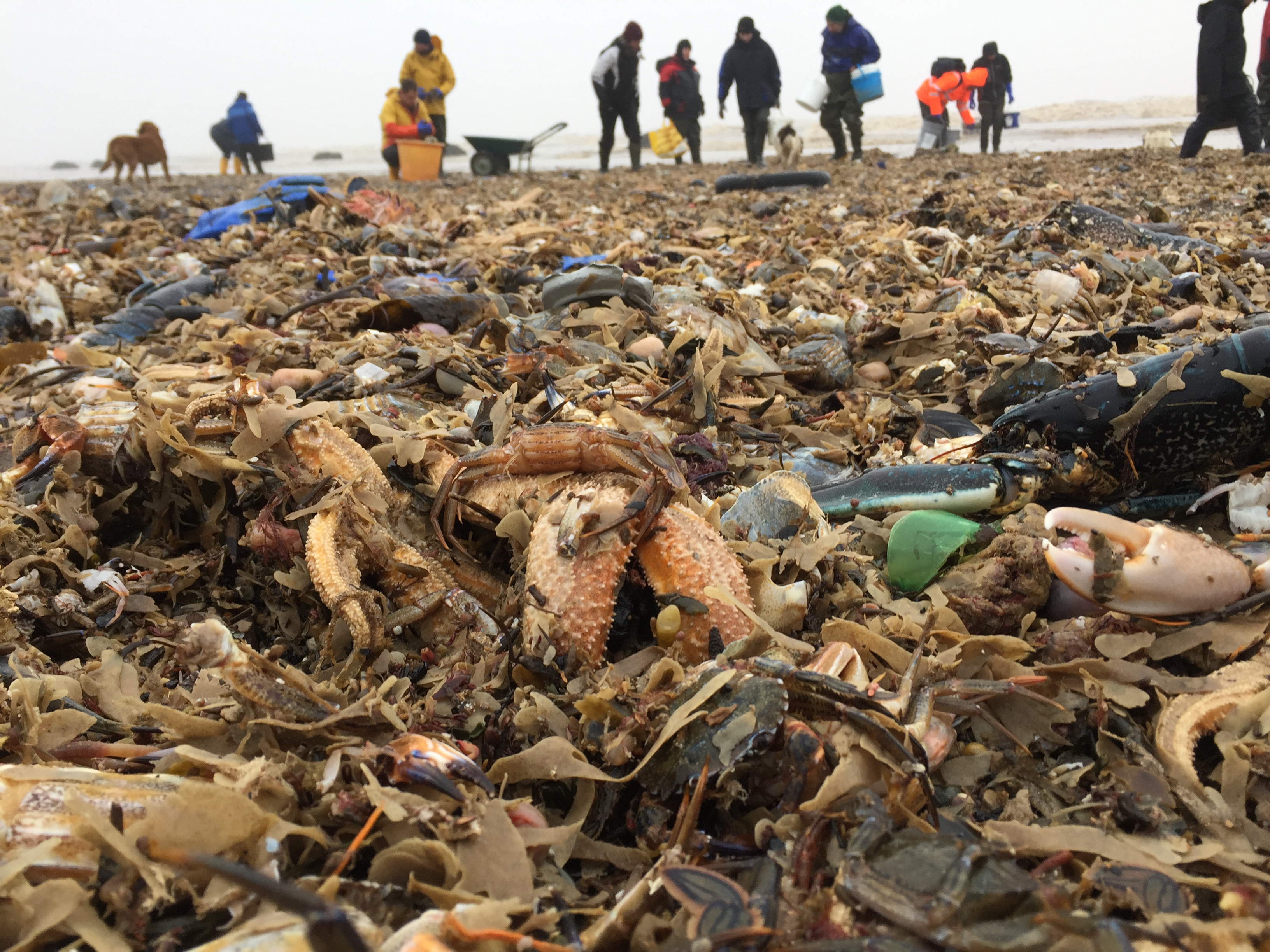
Beached! is a new project which aims to map the mass accumulations of dead or dying sea life on our beach strandlines, from Southport to Aberdyfi. These are a common and, mostly, natural occurrence as part of the cycle of life in our seas but we know very little about where or why these ‘wrecks’ occur.
Why do we want to know about dead stuff?
The Irish Sea is very productive and this is evident when looking at the strandline which is where the remains of animals and plants often end up after they have died.
Looking at what ends up on the strandline helps us understand what is happening offshore.
Beached! hopes to answer two questions about our strandline:
1. Every now and then the strandline is dominated by large numbers of dead and dying animals of one or two species. What might have caused this? We need to record these ‘wrecks’ of marine life in order to later analyse things like the weather that occurred at the time.
2. Where are the best strandlines? Concentrations of shells and other things build up at certain spots. Are these always in the same place and are different species found at different times of year?
You can help us learn much more just by taking photos on your mobile phone!
How to take part in Beached!:
- Register for free with your local participating records centre.
- Take a photo of the wreck, noting its approximate length (if possible a GPS location). Take a close-up photo of each individual species present.
- Go home and record your finds with your local records centre, on the Beached! page.
- Your records will then be verified and added to the database.
- Sign up to our mailing list to receive our newsletter and further information about the project.