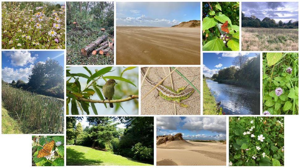
This Annual Monitoring Report gives an overview of monitoring of Local Wildlife Sites (LWSs) in North Merseyside for the survey period 1 April 2020 to 31 March 2021. The report includes methods used to survey each site, results and discussion on any trends observed. Local Wildlife Sites (LWSs) are non-statutory designated sites which aim to...
The State of Britain’s Larger Moths 2021
The world is facing a biodiversity crisis. An estimated one million species are threatened with extinction¹, vertebrate populations decreased by 68% on average between 1970 and 2016² and globally agreed targets to reduce the pressures on biodiversity have not been met³. The trends of insects, which make up at least 60% of all species on...
Changing flora of Devil’s Hole, Ravenmeols – 2022 update
Summary The ‘Devil’s Hole’ is a large active blowout that originated in the early 1940s at Ravenmeols Local Nature Reserve on the Sefton Coast dunes. Wind erosion produced two calcareous, seasonally-flooded, dune-slacks that are still growing. Their floristic development was studied between 2004 and 2022, annual changes being monitored from 2012. By 2022, a total...
The Newest Green Beach at Ainsdale, Sefton Coast – 2022 update
Floristic data were collected each year from 2011 to 2022 on embryo dunes and an associated wetland that began to form on Ainsdale beach in 2008 as a southern extension of Birkdale Green Beach. Named the ‘Newest Green Beach’ and eventually covering 2.4 ha, this feature developed rapidly by accretion of blown sand, initially around Puccinellia maritima (Common Saltmarsh-grass), to form a dune ridge over 4 m in height, protecting a seasonally-flooded primary dune-slack. By 2022, 245 vascular taxa (species subspecies and hybrids) had been recorded for the feature. Annual totals initially showed an almost linear increase in the number of plants over time.
